Article of the Month -
May 2012
|
MERCATOR
Jan de Graeve (Belgium), Director of the FIG IIHSM
1) The paper is written by Jan de
Graeve, FIG International Institution for the History of Surveying and
Measurement and honorary member of FIG, to celebrate the 500 anniversary
of Gerand Mercator. Furthermore it will be presented at the FIG Working
Week, History Workshop in Rome, Italy May 2012. The paper is a short
introduction to the life and work of Gerand Mercator to highlight the
exceptional place he has in the history of the surveying profession.
Keywords: Mercator, Quincentenary, Atlas, Projection.
SUMMARY
2012 is the quincentenary of the birth of Gerard Mercator. Although
best known for the map projection named after him he was also known for
the Mercator Atlas, indeed even the introduction of the word "Atlas" and
for his work in cartography but maybe not so much for his basic work as
a land surveyor. This paper is a short introduction to his life and work
to highlight the exceptional place he has in the history of our
profession.
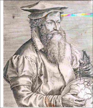
Figure 1. Gerhard Mercator
INTRODUCTION
Gerard Mercator's name rings a bell, as a cartographer, the Mercator
atlases, the Mercator projection, construction of mathematical
instruments and globes, but primarily he made his living as a land
surveyor. He was born in Rupelmonde, in Flanders, on March 5th 1512, 500
years ago, from parents who sold and repaired shoes on market places.
His original name was Gerard de Cremer (a market merchant) and his name
was latinised during his studies at Louvain. The University was
chartered in 1525 and basic studies were the trivium and for those
studying sciences the quadrivium of arithmetic, geometry, astronomy and
music.
During his studies, he met Gemma Frisius who introduced him to
astronomy. As he had difficulties understanding the complexity he
started reading geometry, using an Euclid edition by Vogeler, published
in l529 in Strasburg: Elementale Geometricum ex Euclide Geometra, a
Jerome Voegeler as a start. To get an advanced knowledge, he went on to
read Oronce Fince's: Liber de Geometra Practica, 1544, either the Latin
or French version. This we read in a letter he sent to Mr Haller in
1581, to whom he explained how he improved his knowledge of geometry. In
the same letter he explained how he read about border disputes, in some
book, but could not remember the name of the author. I found out that it
must have been the Galland first edition of 1544: De Agrarum
dimentionibus.
This convolute of Latin texts from the Roman authors explains that in
Roman times the lands were allotted to the veterans once they became 40
years old and received their salary for a long life serving the army.
This book deals not only with the mathematics of land division and
border limits but explains the law systems and legislation that has
governed most land divisions in the Roman empire, not only in Italy but
also in North Africa, Spain and other Roman territories.
The surveyors used a "secret language", a kind of coordinates in
length to find distances between the border stones. This system could
still be of some inspiration for our colleagues today. As a Land
Surveyor Gerard Mercator had practised measuring land and solving border
disputes, well before starting his career as a cartographer.
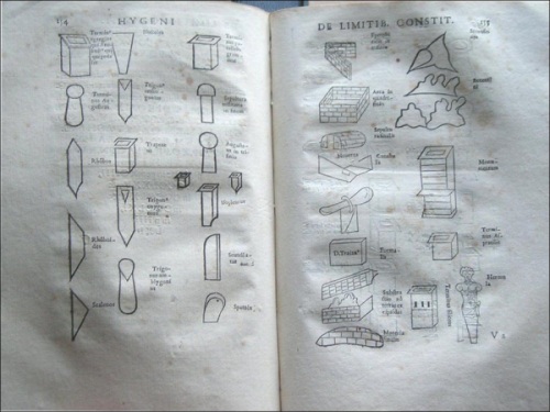
Figure 2. Galland: Borderstones of Roman times
From Gemma Frisius he read: De locorum describendum ratione,
published for the first time in 1533, as an annex to Petrus Apianus:
Comographia by Bonte in Antwerp. The principal was simple. In a triangle
there are 3 angles and 3 distances. If you know 1 distance and 2 other
data, you can solve the triangle, and find (or calculate) the other
elements. It was written in Diets or Flemish. The instruments were very
much like the back of an astrolabe, used in a horizontal manner.
His first important map, presented to the Emperor Charles V by the
city of Ghent in 1540, was called: The Flanders Map. It was a fairly
precise map using the intersection method explained above. He was
commissioned to produce this beautifully engraved map by Granville, but
he did not do the field work; Dr Eric Leenders and I found evidence that
Jacob van Deventer did the fieldwork. Jacob van Deventer measured all
countries belonging to the emperor Charles V. (1500 - 1557).
The cities from where the other villages were intersected were marked
by a double concentric circle. Curiously no historian or cartographer
had understood the significance of this double circle. The larger cities
are engraved and marked with a large church symbol, the smaller with a
small chapel. Of this the centre was each time marked with a single
circle.
Only Gerard Mercator used this system and it is only very recently
that this system was unveiled to the world of the cartographer. This is
despite the fact that the original text on the map of Ghelderland (in
the Netherlands) clearly explains it "in Dutch". Unfortunately not so
many scholars read the inscription on the maps, which are often written
in Latin or in the vulgar languages from 16-l7th centuries and are more
difficult to read or rather "decipher", or are printed in Gothic.
This major achievement in a short time ( a half year for the
engraving) could only have been realised by a close collaboration
between the land surveyor measuring from church towers and forming the
triangles into a small network. The engraver was G. Mercator.
The instrument for measuring the angles had a compass built into the
full circle and the instrument could be oriented to the North (magnetic
north). The deviation of the compass was only discovered later although
Mercator made a substantial contribution to describing the deviation of
the magnet and finding out that the magnetic Pole was not situated on
the Earth's North - South axis through the Poles. He described that in
his correspondence with John Dee, from Cambridge.
In 1546 Gerard Mercator wrote a long letter to André Perrenot de
Granville on February 23 rd. where he explained that the magnetic North
did not correspond with the geographic North. The implications were the
need for map projections. He was apparently one of the very first to
describe the magnetic deviation.
In 1544 G. Mercator was suspected by the "Holy Inquisition" of heresy
and put in jail for 6 months in the fort of Rupelmonde. In fact, he was
solving a property dispute in what is today Zeeland, between the
villages of Axel and Hulst, where 2 religious communities of Ghent, the
Abbey of St-Pieters and the Abbey of St-Baafs, both claimed the same
land to be their property.
At the same time Gerard Mercator stayed in Rupelmonde to solve some
inheritance problem as well, from a deceased uncle of his. As he was
absent from Leuven, where he normally lived with his family (Barbara
Schellekens and children Romuald, Bartholomeus, Arnold and Emily), the
sheriff was looking for him as he was on a list of' possible heretics,
some of which had been executed.
In the l6th century, the propagation of protestantism was firmly opposed
by the Roman Catholic Church, and the books by Calvin, Luther, Zwingler
and others were not allowed by law and prohibited, the sanction: the
death penalty.
This is probably one of the reasons why Gerard Mercator moved in
March 1552 to Duisburg, in Germany on the Rhine. One of his great
patrons, the Emperor Charles V had abdicated in 1550 and moved to Juste
in Spain. The prospects to see a university created in Duisburg was
another reason to go and live in a more tolerant religious environment.
Gerard Mercator measured a large part of Lotharingen (in the French
region of Lorraine) and during the time spent there he injured himself
seriously, he fell ill and never returned to land surveying leaving this
activity to his son Romauld who measured the city of Duisburg and Arnold
Mercator received a privilege from Maximilian II for a map of Koln in
1571.
Gerard Mercator did read a lot of books, and his library was sold in
1604 l0 years after he had passed away. A public auction of the Mercator
library was organised in Leyden (Netherlands), an impressive 1000 books,
in 900 volumes, were sold: there were also religious books: 50% catholic
books and 50% others, historic works, scientific books and others.
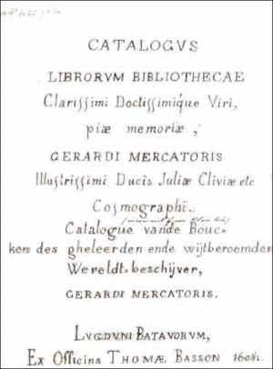
Figure 3. Auction catalogue transcription
A large portion of the history books involved what we would call
geography. There were about 200 books on mathematics and also Libri
Politores, which we could call "rare books". Most books in l6th century
were written in Latin, the universal language, but also in "Gallici",
books in Italian, Spanish and French, and Teutonici: English and or
Flemish (Diets) and German.
In the 19th century, there was controversy between scholars about
Gerard Mercator; was he German?, was he Flemish?, born in 15l2 in
Flanders, he went to Duisburg in 1552 and died there in 1594, so 40
years in Flanders and 42 in Germany. He signed always: Gerardus Mercator
Rupelmondanus or GMR, as, for example, on the border of an Astrolabe. In
fact he was a real European writing and reading in Latin, the learned
language, Flemish or Diets, French, English, German, Spanish, Italian
but no Greek. The books in his library were printed in many languages
and we found his correspondence also in all of the above languages.
Although Gerard Mercator did not travel very much even for a l6th
century learned person, from his correspondence we understand that he
had a fairly good knowledge about the latest discoveries not only in the
New World but also in Central and East Asia.
One of his most important contributions for the time was his
Chronology which he produced in folio in I567, first edition. From his
readings he chronologically wrote down all the important events known in
history books not only the dates of coronations or deaths of kings,
battle fields or peace treatises, but also natural phenomena, earth
quakes, volcanic eruptions, appearances of Stella Nova, sun - and moon
eclipses noted in history books and he recalculated them all in the
different calendar systems: by the Jewish - Greek Olympiades - in Roman
calendar from Romulus and Remus and by the Mohammedan and Christian
calendars. A second edition appeared in 4º in 1575.
His chronology, and his publication of the revised Ptolomeus Atlas,
as part of his Opus Magnus including geography and cosmology, was
unfortunately not finalised before 1594.
THE MERCATOR PROJECTION
We cannot ignore the Mercator projection as it is still in use today
particularly in navigational maps for aviation. In navigation a major
problem was to draw on a flat map a large region which is on a spherical
globe. One has to explain in two dimensions a three dimensional reality.
If on a ship you want to go from A to B, you can calculate the angle
that your ship will cross the meridians passing through both poles. The
line which joined the points crossing all the meridians with a similar
angle, is called a loxodrome, which is a complex curved line ending up
near the pole, but is intricate to calculate.
Mercator tried to understand and solve the problem by turning the
complex loxodrome into a straight line and changing the meridians into
parallel lines, distorting the areas near the poles. To compensate he
invented the system of increasing latitudes. He applied his system in a
famous world map Ad usum navigatium, 1569, but it took a long time
before the system was mathematically explained and proved by William
Wright in Certain errors in Navigation, published in 1599 and 1657.
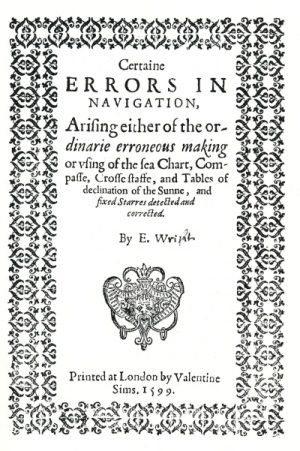
Figure 4. Edward Wright: Certain Errors of navigation
THE MERCATOR ATLAS
Before 1595 there had been individual map productions and also
volumes published with many different maps. The candidate buyer chose
the maps he needed and had them bound together. So, if you wanted to go
from Central Europe to Jerusalem, you do not need the maps of Spain, nor
Portugal, nor France nor parts of Africa.
For travelling to the Americas those maps were essential even if they
were imperfect but the rest of the world was then not needed. If you
want to go from Rome to Antwerp or Amsterdam, you need the maps of
Italy, Switzerland, Germany and the l7 provinces. The maps were bound
together on demand. Mercator issued the full set of maps. His first
atlas, published posthumously in 1595, by his son one year after he
died, was given the name "Atlas", which has been in use even since.
On the occasion of the 500th anniversary, a facsimile has been issued by
Mercatorfonds in folio edition, and a Verlag produces a large reprint in
full size in colour. The learned introduction to both is written by Dr
Thomas Horst from Munchen originally in German, but translated into
English, French and Flemish (Dutch).
Mercator died in December 1594 in Duisburg, at the advanced age of
82. He is remembered for the Atlas, and his projection with increasing
latitudes. As a perfectionist, he always wanted the ultimate precision
which he learned in his earlier career as a land surveyor.
He will be remembered as a Great European Land Surveyor and
Cartographer.
Coming Events
To commemorate GERARD MERCATOR. many events are planned and prepared
- In Rupelmonde, their Highnesses Prince and Princess PHILIP of
Belgium have unveiled a sculpture of the young Mercator, to inspire
the future generation that every one can become an important person.
- In St-Niklaas: an exhibition in the local Museum STEM; the at
the library of Gerard Mercator on the other side of the park is an
exhibit "Mercator Digitalised" together with an exposition of 4l
mathematical books from the Gerard Mercator library by Jan De
Graeve. This runs until 1st July 2012.
- An international colloquium from 24 to 27 April 2012, in
St-Niklaas and also
in Antwerp: Plantin Moretus Museum: "Mercator and travelling in l6th
century"
- In Dortmund: A major exhibition in the city museum: "Mercator,
surveyor and
Cartographer" (600 m2)
Jan De Graeve published The Mercator Scientific Library, in "Le Livre
et L'Estampe" 202 pages + illustrations
References
- Le Livre et L'Estempe, journal of the Belgian Bibliophile
society of Aril. 2012. A 202 page paper by Jan de Graeve on the
scientific library of Gerard Mercator.
- The photographs are from a presentation made about the books in
the Author's library.
Biographical notes
Jan de Graeve is Director of the International Institute for the
Hstory of Surveying and Measurement. (IIHSM). He is an Honorary member
of FIG.
Contact
Prof. Jan de Graeve,
Director IIHSM,
1020 Brussels,
5 Ave de Meysse,
Belgium.
Tel. 0032 (0)2 268 1025
Fax: 0032 (0)2 262 1033
 |