Representatives from FIG attended 11th South East Asian
Survey Congress
22-24 June 2011, Kuala Lumpur, Malaysia
|

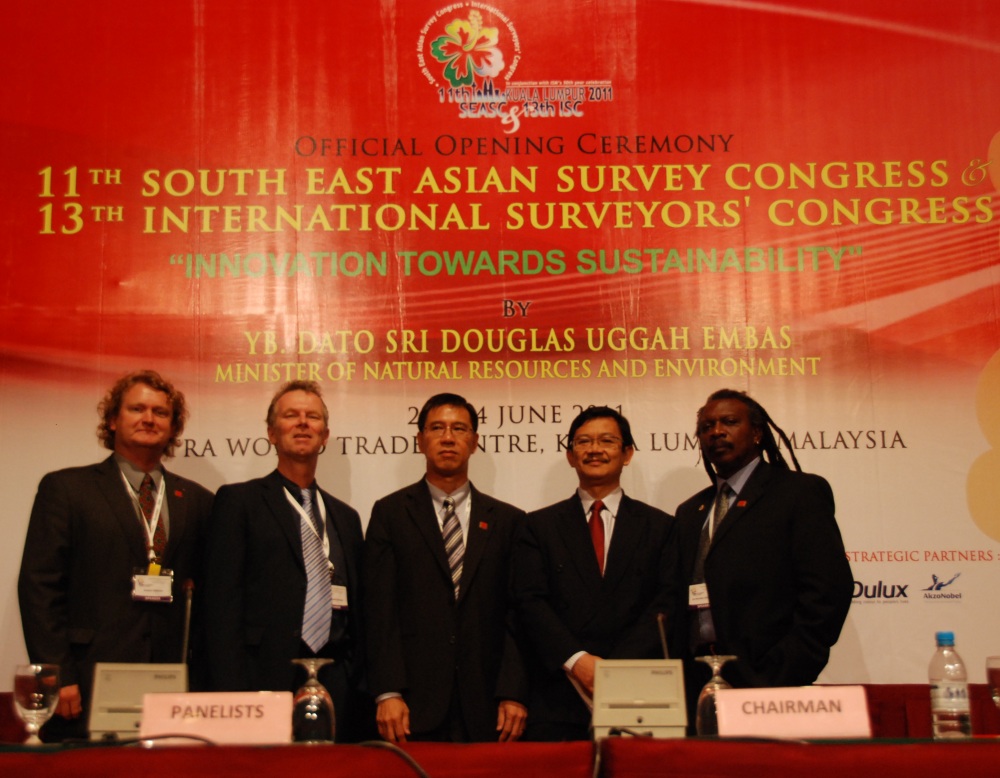
Robert Šinkner, Chair FIG Commission 10 (Construction),
Christiaan Lemmen, Director OICRF, CheeHai Teo, President
FIG, Ahmad Fauzi Nordin, chair of the Organizing Committee.
Michael Sutherland, chair of Commission 4 (Hydrography) |
The eleventh South East Asian Survey Congress was held this year in the
Putra World Trade Centre, Kuala Lumpur, Malaysia, home town of FIG president
CheeHai Teo.
Under the congress theme ‘Innovation towards Sustainability', about one
thousand participants were welcomed by the President of Institution of
Surveyors Malaysia Sr Elvin Fernandez; the President of the ASEAN
Federation of Land Surveying and Geomatics (AFLAG), Ms. DiahKirana
Kresnawati and by the President-elect of the Royal Institution of
Chartered Surveyors (RICS): Sr Ong See Lian. Proceedings were opened
by the Minister of Natural Resources and Environment, Dato Seri Douglas
Uggah Embas, who urged surveyors to be ‘well prepared to take on new
challenges - to venture into new areas of discovery and development, through
shared knowledge and creative innovations'. Under the chairmanship of Sr
Ahmad Fauzi Nordin an excellent programme was prepared in
co-operation with FIG President CheeHai Teo and Sr Teng Chee Hua
from the Surveying and Mapping Department.
Broad Coverage
The conference offered broad coverage of the survey profession, from
modern geodesy to land administration and valuation, real-estate markets to
3D and Marine Cadastres, and from sustainable construction engineering to
software developments. Keith Clifford Bell from the World Bank
presented a very comprehensive overview in his paper ‘Focusing on Innovation
and Sustainability in Rural and Urban Land Development: Experiences from
World Bank Development Support for Land Reform’.
Twenty survey experts were invited, including five presidents and
president-elects of international organisations: Sr Ong See Lian,
RICS, Prof. William Cartwright, International Cartographic
Association, Dr Abbas Rajabifard, Global Spatial Data Infrastructure,
Prof. Chris Rizos, from the International Association of Geodesy, and
FIG president CheeHai Teo. While many speakers were well-known names,
some of the most surprising speeches came from ‘outside', really motivating
the audience to be different, change the rules of the game, think outside
the box, get feedback and innovate. Heera Singh brought most
interesting examples here.
Almost a thousand participants and roughly forty exhibitors took part
under Platinum sponsorship of Trimble and ESRI – with keynotes from Chris
Gibson (Trimble) and Brent Jones (ESRI).
FIG was well represented by several invited speakers. Prof Iain
Williamson presented a keynote on ‘Lessons for Federal Countries that
have State Land Registries - The Australian Experience’. Christiaan
Lemmen, director OICRF, had a keynote on ‘Society Driven Innovations in
Land Administration’, Robert Šinkner, Chair Commission 10
(Construction), presented a paper on Sustainable Development in using of
Maps and Geospatial Data for GIS/MIS Systems in comparison with availability
of Graphical Data in the last centuries in the Czech Republic and in Europe
and Michael Sutherland, Chair Commission 4 (Hydrography) on
Implementing Marine Cadastres
Not to be Ignored
A total of 138 papers made up the technical sessions, workshops, open
forum and technology updates, seventeen presented in the plenary and the
rest in other sessions. The plenary sessions covered a lot of ground: World
Bank support for sustainable land reform, the Australian experience in
improving land information management, and emphasis on the need to use GIS
to help people understand complex problems and make better decisions.
Also discussed were issues associated with re-engineering SDI design to
support the new vision of spatially enabled government and society. The
characteristics of modern geodesy were presented, and how it was helpful to
regard applications and technologies as belonging to the broad field of
earth-observation science. The real challenge was to make GeoInformation so
accessible that it cannot be ignored by policy-makers.
BIM: a Proven Trend
Building Information Modeling was described by Prof. Michael L. Riley
as a spatial modeling trend which has proven its efficacy. More
process-oriented than data-oriented, BIM should both excite and engage our
profession, although there are obviously data and legacy issues, as well as
technological, to be addressed.
The need for robust valuation runs deep and wide in the financial system,
and valuations not only support banking systems but also good corporate
governance, as well as providing the key to efficient functioning of
property markets. Continual updating of standards and best practice
guidelines were important here.
The China forum was interesting, introducing the latest developments from
China in terms of survey instruments, GIS software and access to geodata.
Going Green
Many presentations encouraged green behaviour. The message from Dr.
Ann Heywood: it's important for the occupier of a building to behave
in a sustainable way within a sustainable building.
Christiaan Lemmen
Director OICRF
September 2011
Read more:
20 September 2011
|