Commission 3, through the coordination of the Chair Enrico
Rispoli and the contribution of the four working groups,
composed of professionals and academics from around the world,
has achieved excellent results in participations and
involvements of members.
Thanks to the cooperation of the delegates, more research
have been in simple and reliable method of collecting,
monitoring and managing data concerning the territory
(geographical, aero photogrammetric, geomorphological, economic,
land, statistics, etc.).
The technical and working sessions focused on the following
matters:
SIM Infrastructure;
Technical Aspects of SIM;
3D Cadastre;
Crowdsourcing and VGI supporting SDI.
SDI at all levels – local, regional, national and
global;
SIM challenges – natural and environmental risk
prevention and disaster management, mitigation, waste
management, etc.;
VGI collection, dissemination, analysis, applications,
maintenance and visualization;
e-Governance and SDI in supporting decision making –
theory, applications and best practice;
Integration of SDIs – cadastre, land use, utilities,
environment, socio-economic;
Utilization of VGI and Crowdsourcing with SDI, SIM and
environmental information;
2D/3D/4D geospatial models, algorithms, visualization,
standards and applications;
Web and mobile GIS – challenges, services and real-time
capabilities;
Business models and SDI, public-private partnerships and
economic aspect.
The importance of the general topics as SDI, SIM, GIS, etc.
together with VGI and Crowdsourcing has drawn the attention of
many delegates who have allowed to carry out interesting working
sessions during the FIG Working Week in Helsinki and during the
Commission 3 Annual Meeting and Workshop.
Work Plan
Terms of Reference
The use of Spatial Information Management (data, tools,
procedures, regulations, standards);
The support of Good governance (sustainable development, poverty
reduction, social and economic growth, social security);
Spatial data infrastructure;
Research on the use of crowdsourced VGI data and derived
information to geoscientific disciplines that make use of mapping,
GIS, and Geo-SDI systems and procedures;
The research of the methods for the sustainable development
especially of mega cities and emerging countries with high index of
development;
The study and monitoring, as control of the fragility and
vulnerability of the territory.
Mission statement
The mission of Commission 3 is to:
Increase awareness about successful SIM approaches and
achievements within the “e-Society” by showing good practice like
availability, reliability, efficiency and accessibility of spatial
information for better decision making and processes.
Support the use of spatial information and SIM-tools by surveyors
and by all participants in decision-making to serve the goals of good
governance.
Share good practice on managerial processes and infrastructure
required for data handling, using information and distributing
knowledge.
Share good practice and develop high-level methods and techniques
for merging and managing updated spatial information at various levels
according to market requirements.
Establish and maintain data - and data-quality-standards relevant
to SIM, while cooperating with international spatial data standard
committees.
Encourage the use of spatial information within e-government and
e-commerce.
Cooperate and coordinate with the related United Nations
Committees and other geospatial information societies and
organizations active in the field based on request from the Council,
they key focus will be in co-operation with ISPRS (Commission IV on
Geodatabases and Digital Mapping), ICA (commission on Geospatial Data
Standards), GSDI, EUROGI.
SIM has the role of an integrator of components for a Spatial
Information Infrastructure especially for urban areas within the
information society. SIM is a facilitator for IT based services for
planners, administration as well as for citizens.
Chair
Prof. Dr. Hartmut Mueller
GERMANY,
E-mail: hartmut.mueller[at]hs-mainz.de
Working Group 3.2 – Technical aspects of SIM
Policy issues
The on-going development of tools, techniques and policies for spatial
management of urban areas, in particular cities/megacities but also rural,
forest and coastal areas leads to the need for collection, management and
integration of various spatial data, such as: optical and SAR satellite
and aerial images, images derived from various kinds of UAV, images
derived from the Internet, orthophotos, point clouds derived from LiDAR
and terrestrial laser scanners, global DTMs, etc. These data and the need
for their management in real time or in a short time, in order to monitor
growth and change across the urban environment and to forecast areas of
risk, leads to the development of specific techniques for Big Data
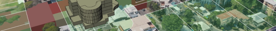
management. The on-going development of 3D and 4D spatial or city models,
using photogrammetric or computer vision techniques, demands the
development of interoperable formats and tools for the exchange of
geometric and semantic 2D/3D data and information. The improvement and
enrichment of data and spatial product quality control methods and
techniques is an important issue as the variety of data collection sources
and information management and integration procedures become wider.
Working Group 3.3 – 3D Cadastre (Joint Working Group with Commission
7)
Policy issues
The results of the previous term (2010-2014) of the working group
provide a solid basis for the next 4-year phase of the working group. The
concept of 3D Cadastres is here to stay and the number of implementations
is increasing, quite often with ambition to become LADM (ISO 19152:2012)
compliant.
In 3D, it is even more important to connect land administration to
other registrations via SDI: buildings, tunnels, cables/pipelines, terrain
elevation, etc. (physical and legal 3D objects should be aligned). The
main objective of the working group is to establish an operational
framework for 3D-Cadastres. The operational aspect addresses the following
issues:
A common understanding of the terms and issues involved.
Concepts should be refined and agreed based on the ISO 19152 Land
Administration Domain Model.
A description of issues that have to be considered (and to what level)
before whatever form of 3D-cadastres can be implemented. These will
provide 'best practices' for the legal, institutional and technical
aspects.
Chair
Peter van Oosterom, The Netherlands
email: P.J.M.vanOosterom[at]tudelft.nl