News in 2024
|
Surveying - Registration - Valuation
How we gather and deal with our data today
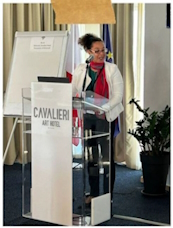
5-7 February 2024 – Cavalieri Art Hotel, Malta
Report on the EGoS and FIG Commissions 3 and 9 Joint Workshop in
Malta
This workshop, a joint event of Commissions 3 and 9, aimed to map and
bridge the gap that exists in the lifecycle of data collection and
management, facilitating land and cadastre valuation. The workshop
commenced on the afternoon of February 5 with a welcome reception
organized by the European Group of Surveyors (EGoS) and representatives
of FIG Commissions 3 and 9, alongside the warm hospitality of the Malta
Institute of Surveyors (MIoS) officiated by Mr. Randolph Camilleri and
Mr. Alan Micallef.
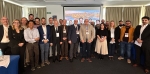
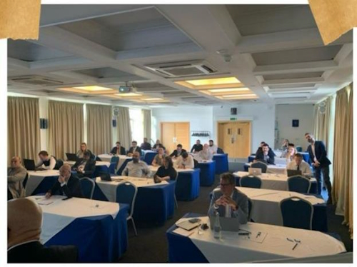
The first day started with a Welcome Session for the 40 workshop
delegates and participants. The speakers included Mr. Nikos Zacharias,
the President of EGoS, who warmly welcomed all 40 participants; Mr. Alan
Micallef, the previous delegate to the FIG YSN and current President of
MIoS, expressed his gratitude for hosting the workshop; Mrs. Diane
Dumashie, President of FIG, welcomed everyone, both newcomers and
veterans, reminding them of FIG's vision and mission for today and
tomorrow; Dr. Sagi Dalyot, Chair of FIG Commission 3, attended the
opening session online and illustrated the critical role of spatial data
and spatial information management in numerous applications,
particularly in land management and valuation; Mr. Peter Ache, Chair of
FIG Commission 9, introduced his work plan for his term and outlined the
efforts needed for a more transparent real estate market.
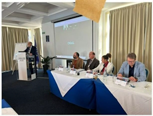
The Plenary Session was a dedicated forum focused on the pivotal role
of surveyors within the global landscape. Dr. Diane Dumashie
spearheaded the session, elucidating FIG vision for 2030 and emphasizing
the paramount importance of collaborative efforts in Land Governance.
She underscored the necessity of a proactive stance in confronting
global challenges for the betterment of society, stressing the
indispensability of connectivity and continuity in upholding the
integrity of our profession.
Following Dr. Dumashie's insights, FIG past-President, Prof. Chrissy
Potsiou, delved into the surveyors' role within the framework of UNECE
(United Nations Economic Commission for Europe), providing a
comprehensive overview of the current landscape and ongoing research
pertaining to land policies and economies. She concluded her address by
announcing the forthcoming UNECE Workshop scheduled for 2025, aiming to
further explore and address pertinent issues in this domain.
Mr. John Hohol, FIG Foundation President Emeritus, extended a warm
welcome to the attendees, underscoring the FIG Foundation's dedication
to supporting Young Surveyors and nurturing generational continuity
within the surveying profession. Notably, the presence of several Young
Surveyors at the workshop was made possible through the steadfast
support of the FIG Foundation, reflecting its commitment to fostering
the development and engagement of emerging talent within the field.text
Main takeaways from the Technical Sessions of the first day are:
- Fit-for-Purpose Digital Twin for 3D Cadastral and Land
Management: A research project conducted in Greece
showcased the practical application of digital twins for 3D
cadastral and land management. This innovative approach offers
stakeholders and policymakers a visual representation of community
transformations over time through cadastral data. It enables
analysis of the impacts of such changes on various real estate
sectors, including commercial, residential, and mixed-use buildings.
- Comparative Study on Level-of-Detail (LoD) in 3D Urban
Modelling: A comparative study examined the appropriate
Level-of-Detail (LoD) to be utilized in 3D urban modeling,
particularly in disaster-stricken areas like Popoli, Italy. The
availability of different LoDs proves beneficial for post-emergency
scenarios, aiding in relief operations, repairs, and reconstruction
efforts.
- Geospatial Technologies in Valuation and Real Estate:
A technical session focused on the application of geospatial
technologies in valuation and real estate. Examples included the use
of GIS software for Automated Valuation Models (AVM) and spatial
regression analysis. Challenges such as the accuracy of data
collection and the transparency of location data were discussed,
considering factors like open-source data, crowdsourcing, and
industry-led data collection.
- Evolution of Surveying Education: Insights from
the University of Chieti Pescara and representatives from the FIG
Young Surveyors Network and FIG Commission 2 highlighted the
changing landscape of surveying education in universities.
Discussions revolved around how slight changes in terminology can
impact perceptions of the surveyor's role in an increasingly digital
society.
- Utilization of Spatial Data in the Government Sector:
Colleagues from the Kingdom of Saudi Arabia shared their country's
efforts in leveraging spatial data within the government sector.
They discussed recent technological advancements and partnerships
that have positively impacted the economy and finances, showcasing
the potential of spatial data in driving progress and development.
Overall, the Technical Sessions underscored the importance of
innovation, collaboration, and adaptation within the surveying
profession, particularly in the context of emerging technologies and
evolving societal needs.
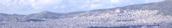
The first day concluded with a captivating tour of the old capital of
Medina, a historic fortified city nestled in the heart of Malta. Medina
exudes an ambiance steeped in rich history and diverse cultures,
offering visitors a glimpse into its storied past while seamlessly
adapting to the evolving environment beyond its ancient walls. The tour
provided participants with a unique opportunity to immerse themselves in
the timeless charm and architectural splendor of this historic gem,
further enhancing their understanding and appreciation of Malta's
cultural heritage.
The key theme for Day 2 of the workshop was planning, encompassing
spatial planning, urban planning, and disaster planning. Technical
sessions centered on utilizing geospatial data for planning purposes.
The sessions featured research and notable outcomes showcasing the
practical application of new technologies in generating geospatial data
for use in land administration systems, managing complex land parcels,
monitoring mobility, and preserving architecture. Highlights and key
takeaways include:
- Spatial Planning in Unregistered Land:
Colleagues from Greece and the UK shared their experiences with
unregistered land and discussed how various methods of spatial
planning and development are helping to tackle such challenges.
Insights were provided on how unregistered lands are affecting
market values in the study area.
- Spatial Planning in Climate Change: The
spotlight also shone on addressing climate change and emergency
preparedness, where our professional expertise in construction,
monitoring, and planning plays a crucial role. Methods and
experiences from Italian colleagues and Young Surveyors were
presented, with an additional exploration into the extent to which
disaster planning can impact land and building values in both pre-
and post-disaster scenarios.
In conclusion, this year’s FIG Commissions 3 & 9 and EGoS Joint
Workshop served as a compelling convergence of knowledge from two
pivotal sectors within our profession, acting as the ideal nexus between
Valuation and Spatial Information Management. Despite not having been
thoroughly explored in recent times, our societies and communities,
driven partially by economic capacity, must acknowledge the escalating
necessity for accurate geospatial and location data. Such data not only
facilitates enhanced urban planning and economic growth but also
contributes to architectural preservation, fosters healthier tourism,
and ensures food stability and secure land tenure. In doing so,
unnecessary expenditures can be reduced, and the adverse impact of urban
decay on the environment mitigated.
Infinite gratitude is owed to the Organizing Committee for
orchestrating such an insightful event, particularly to Randolph
Camilleri, Malcolm Elliott, Maria Scorza, Nikos Zacharias, Peter Ache,
Sagi Dalyot, Rahmi Celik, and Enrico Rispoli.
In summary:
- 40 delegates from numerous countries participated in this
workshop.
- 16 presentations were delivered throughout the event.
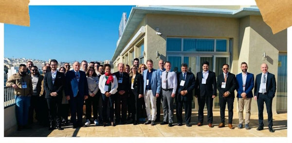
Report authored by Cromwell Manaloto and edited by Sagi Dalyot.
Photographs captured by Cromwell Manaloto (https://www.linkedin.com/in/cromwell-manaloto-90123447/)
February 2024