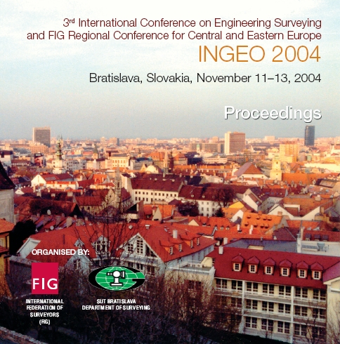
INGEO 2004 and FIG Regional Central and Eastern European Conference on Engineering Surveying
11-13 November, Bratislava, Slovakia
Technical Programme
Technical Programme as .pdf-file
| Thursday, November 11, 2004 | |
| 8:30 – 17:00 | Registration |
| 10:00 – 10:45 | Opening Ceremony Schäfer,
M., Niemeier, W., Nerkamp, K.H. and Petersen, M.
(Germany) |
| 10:45 – 11:00 | Coffee Break |
| 11:00 – 13:00 | TS1 – Data Processing Chair: Vice-Chair:
Pytharouli, S.I., Psimoulis, P.A., Kontogianni, V.A.
and Stiros, S.C. (Greece) Schwieger, V. (Germany) Korbašová, M. (Slovakia) and Marek, J. (Czech
Republic) Erol, S., Erol, B., Ayan, T. (Turkey)
and Tait, M. (Canada) Bacigál, T., Korbašová, M., Villim, A.
and Ždímalová, M. (Slovakia) Bacigál, T. and Komorníková, M. (Slovakia) Parsopoulos, K., Kontogianni, V.,
Pytharouli, S., Psimoulis, P., Stiros, S. and
Vrahatis, M. (Greece) Posters Tait, M. and Hunter, A. (Canada) Kováč, M. and Hefty, J. (Slovakia) |
| 13:00 – 14:30 | Lunch |
| 14:30 – 16:30 | TS2 – Terrestrial Laser Scanning Chair: Vice-Chair
Schulz, Th. and Ingensand, H. (Switzerland) Rietdorf, A., Gielsdorf, F. and Gruendig,
L. (Germany) Koska, B., Křemen, T., Štroner, M.,
Pospíšil, J. and Kašpar, M. (Czech Republic) Scherer, M. (Germany) Stanek, H. (Austria) Schäfer, Th., Weber, Th. (Germany),
Kyrinovič, P. and Zámečniková, M. (Slovakia) Posters Korbašová, M. and Kopáčik, A. (Slovakia) Zámečníková M. and Kopáčik, A. (Slovakia) |
| 16:30 – 17:00 | Coffee Break |
| 17:00 – 18:00 | Poster Session |
| 19:30 – 22:00 | Social Evening Common with FIG WG 6.2, 6.3 and IAG WG 4.2.2
|
| Friday, November 12, 2004 | |
| 8:00 – 15:00 | Registration |
| 8:30 – 10:00 | TS3 – Information Systems and
Facility Management Chair: Vice-Chair: Gielsdorf F., Rietdorf A.
and Gründig, L. (Germany) Matijević, H., Roić, M. and Ivić, S. M.
(Croatia) Milev, I. and Gruendig, L. (Germany) Poljanac, I., Paar, R. and Cetl, V. (Croatia) |
| 10:00 – 10:30 | Coffee Break |
| 10:30 – 13:00 | TS5 – Control Measurement, Industry
Survey and Applications Chair: Vice-Chair: Tait, M., Fox, R.
and Teskey, W.F. (Canada) Neuner, J., Coşarcă, C., Sărăcin, A.
and Ţurcanu, R. (Romania) Ágfalvi, M. and Gyenes, R. (Hungary) Bureš, J. (Czech Republic) Švábenský, O. and Zvěřina, P. (Czech Republic) Ižvoltová, J. (Slovakia) Mentes, Gy. (Hungary) |
| 13:00 – 14:30 | Lunch |
| 14:30 – 16:00 | TS4 – Total Stations in Kinematic
Model Chair: Vice-Chair: Wunderlich, Th.A. (Germany) Santala, J. (Finland) Kadlečíková, V. and Kyrinovič, P. (Slovakia) Depenthal, C. (Germany) Möhlenbrink, W. (Germany) |
| 16:00 – 16:30 | Coffee Break |
| 16:30 – 18:00 | TS6 – GPS Measurement and
Application Chair: Vice-Chair: Hefty, J. and Hrčka, M.
(Slovakia) Bubeník, F. and Hánek, P. jr. (Czech Republic) Tait, M., Sheng, L. and Cannon, E. (Canada) Pikridas, C., Tokmakidis, K., Spatalas, S.
and Tsoulis, D. (Greece) Andritsanos, V.D., Fotopoulos, G., Fotiou,
A., Pikridas, C., Rossikopoulos, D. and Tziavos,
I.N. (Greece) |
| 18:00 – 18:30 | Closing Ceremony |
| Saturday, November 13, 2004 | |
| 9:00 – 15:00 | Conference Technical Tours |
Visiting Tours
-
A) History and Present Time of Bratislava – offered during all conference days
-
B) Carpathian Wine Way – Saturday, November 13, 2004